Plan one of these pilgrim walking routes through France for a different holiday. You’ll get off the beaten track and see parts of France you would normally miss, meet fellow walkers along the way with the same love of the outdoors, and keep fit.
The Pilgrim Walking Routes

The routes, collectively called The Way of St. James, are very well organized, well marked and signposted and offer good accommodation of all kinds on the way. Most of the pilgrim walking routes follow the Sentiers de Grande Randonée. These major routes all have designated numbers, i.e. GR 655 etc.
Note that on French maps, the routes are marked by their Latin names.
Before you start, here’s a short history. Skip it and scroll down if you’re just after information on the four main pilgrim walking routes.
Pilgrims of the Past
From the 10th century on, pilgrims have been making their way through France to the shrine of St. Jacques (St. James) at Santiago de Compostela in north west Spain. In the 12th century, one Aymeric Picaud, a monk and scholar, wrote Codex Calixtinus, the Pilgrim’s Guide to the four great pilgrim walking routes through France. You could call it the first ever tourist guide book.
St. James
St. James, one of the twelve disciples of Christ, travelled to Spain after Christ’s death to preach the new gospel. He returned to Judaea, was captured and beheaded in Jerusalem in 44AD. His body was then taken by boat to north Spain, and buried in the cathedral at Santiago de Compostela.
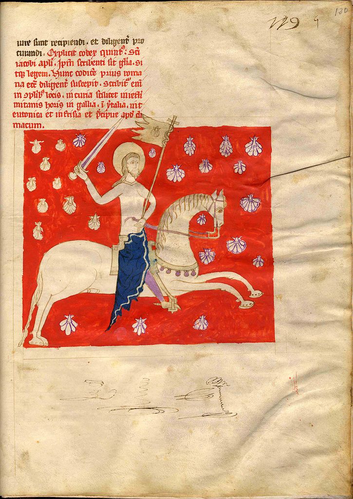
Pilgrim Symbols

You can distinguish an ordinary walker from somebody on the pilgrim route through two main symbols. The pilgrim’s staff is an obvious one. Basically a walking stick, many of them have a hook which pilgrims used to hang objects from.
Scallop Shells
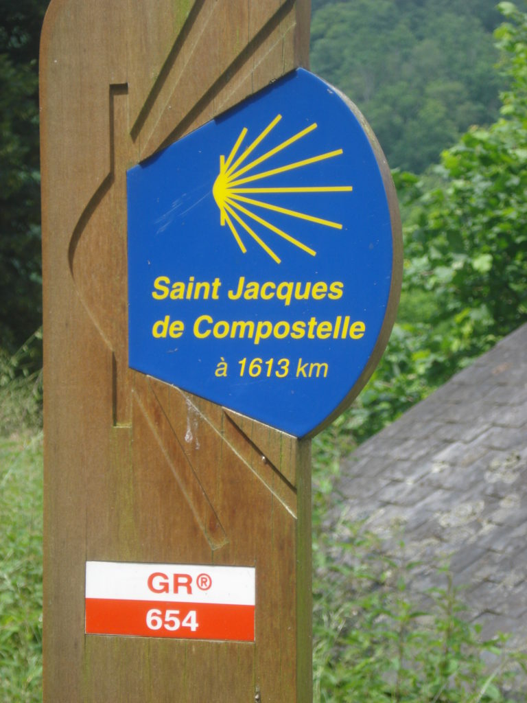
You’ll see the scallop shell everywhere. Many walkers today carry one but more importantly, the pilgrim walking routes have adopted the scallop as a symbol to mark the way. You’ll see it on boards pointing the way in the countryside and on small brass plaques cemented into roads in towns.
Why the Scallop?
There are two explanations for the scallop. The first is that it was given to pilgrims arriving in Santiago as proof of their journey and safe arrival. Fair enough; scallops were native to this part of Galicia. The second one is that the boat carrying St. James’ body from Judaea to Spain capsized and the crew and body disappeared. But miraculously, the body was found on the shore, intact and covered in scallop shells. Take your pick.
The Golden Age of Pilgrimages

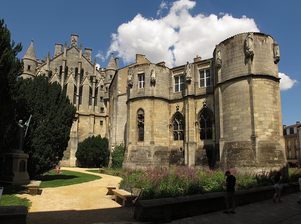
From the 11th to the 13th centuries, pilgrimages had an extraordinary effect on Europe. Abbeys and monasteries were founded to care for the pilgrims. Churches and chapels were built for the pilgrims to worship in…and spend their money. Some churches are great buildings like the cathedral at Amiens, Sainte-Foy in the little village of Conques, and Saint-Sernin in Toulouse, the largest Romanesque building still surviving in Europe.

Roads were developed; special ‘pilgrim bridges’ were built. Some of them survive like the oldest medieval ‘pilgrim’ bridges in France: the Pont du Diable over the Herault at Aniane.
This vast movement of people had a huge impact on Europe. Cultural and religious ideas spread and pilgrims returned home bringing their new experiences and their impressions of different lives and societies with them. It affected all classes of society from the humblest to Kings and Emperors.
A UNESCO World Heritage Site
The Pilgrimage Route of Santiago de Compostela was awarded UNESCO World Heritage Site status in 1998. There are 71 sites on the list. As the citation states: “The Pilgrimage Route of Santiago de Compostela bears exceptional witness to the power and influence of the Christian faith among people of all classes and countries in Europe during the Middle Ages”.
The Four Great Pilgrim Walking Routes in France
There were four major routes during the Middle Ages, starting in Tours, Vézelay, le Puy-en-Velay and Arles. They served as the meeting point for pilgrims from Britain and Ireland, from Scandinavia, from Belgium and the Low Countries, from Germany and Poland. They all converged on St Jean-Pied-de-Port in the Pyrenees. From here the pilgrims crossed into Spain to begin the 791 kms/492 miles walk to Santiago.
The Way of Tours
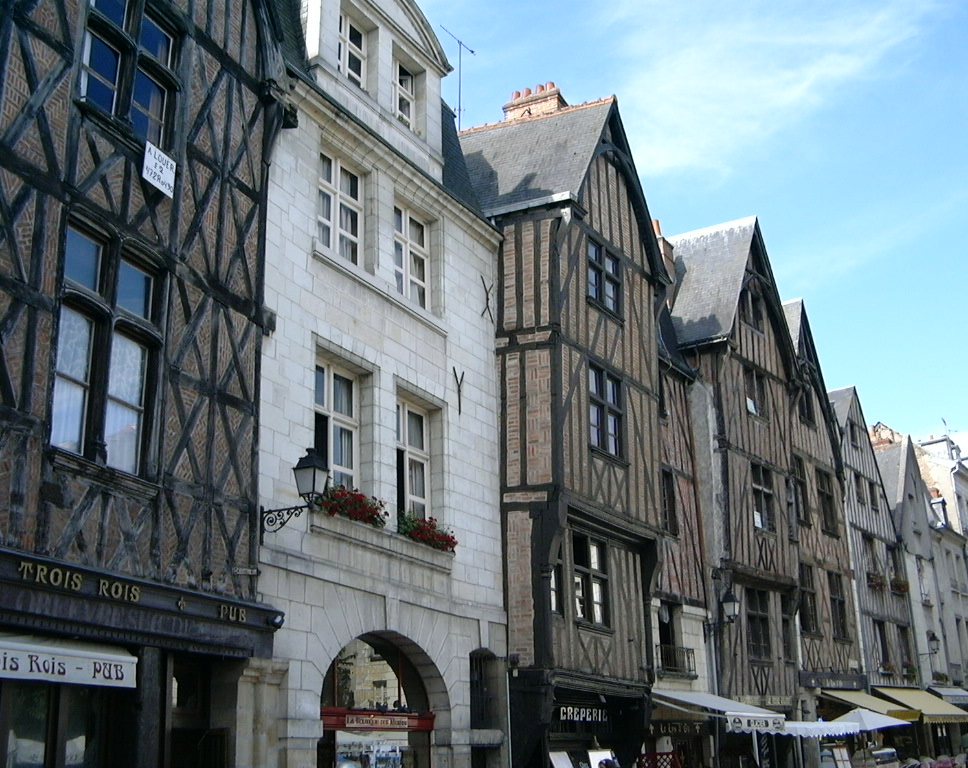
The Way of Tours was the main route used by pilgrims coming from Paris and the north of France, England, Ireland and the Low Countries.
The Way of Tours (Via Turonensis) runs along the walking route, GR 655 which starts at the border with Belgium and goes to Paris via Compiègne. Originally The Way of Tours started in Paris at the Saint-Jacques tower, still standing in the rue de Rivoli.
From Paris to Tours
Today there are two ways from Paris to Tours. The western route goes via Chartres (GR 655 west) and Vendôme and the river Loir with its painted Romanesque churches.
The eastern route goes via Orléans (GR 655 east) past churches like Clery Saint-Andre as well as the châteaux of Blois, Chaumont, and Amboise.
The Route on from Tours
From Tours in the western Loire Valley, the route goes south to the ancient Roman town of Poitiers in Poitou-Charentes. Then it’s on south-west to Saintes, originally an important Roman town with a spectacular amphitheatre and ancient building.
You continue on via Pons with its medieval pilgrim hospital, crossing the Gironde river by ferry at fortified Blaye and then on to Bordeaux on the glorious French Atlantic coast.
Parallel to the Atlantic Coast
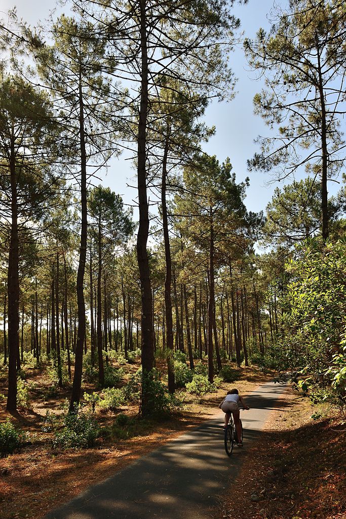
Then the route enters Les Landes, the largest pine forest in Western Europe. It’s beautiful walking country dotted with Romanesque chapels and feels strangely remote as if it’s cut off from the rest of France.
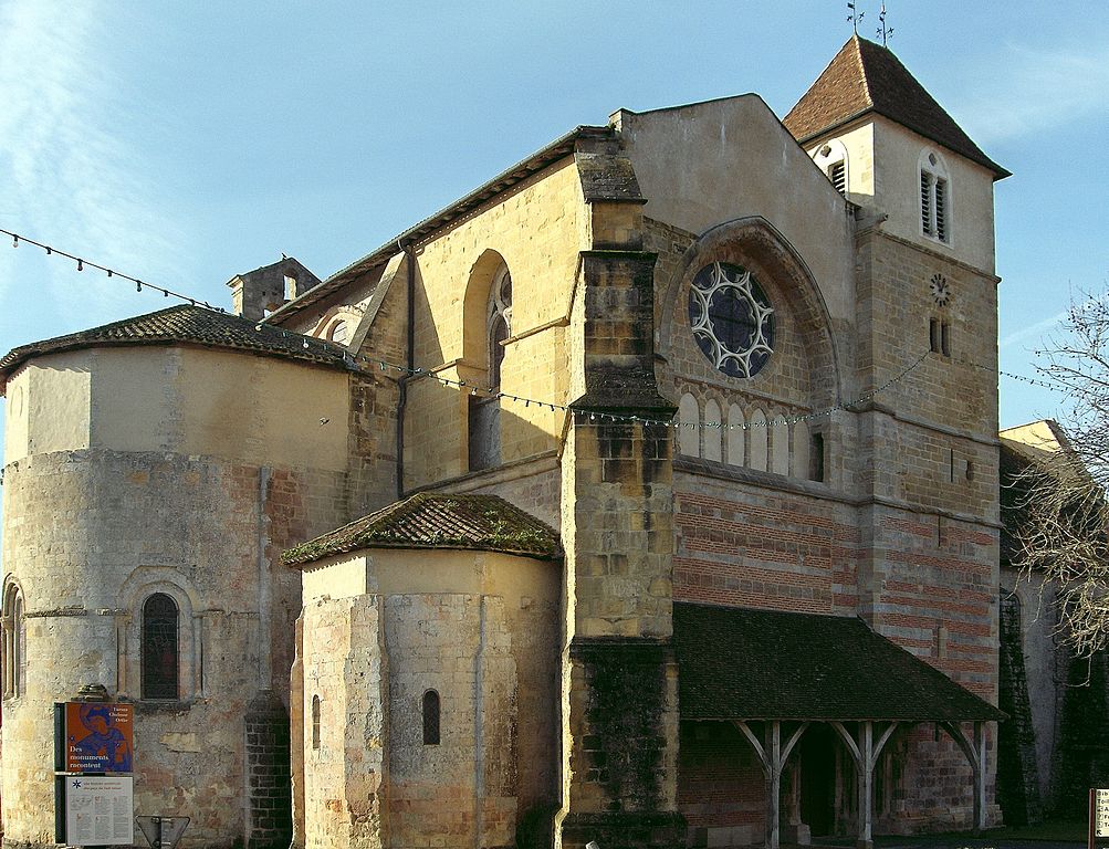
The major spa town of Dax is next. Then you reach Sorde l’Abbaye on the river Adour that flows into the sea at Bayonne. Aimeric Picaud describes the ferryman’s tales of villainous Basques ‘savages’. The route at this stage was particularly dangerous until the abbey was founded to protect the pilgrims.
The route follows small roads to Ostabat and ends at St Jean Pied de Port, a walk of 950 kms/590 miles.
The Way of Vézelay
The Way of Vézelay (the Via Lemovicensis) refers to both the Limousin which the route crosses and Limoges, one of the most important pilgrimage stops along the route. It runs for 900 kms/559 miles from Vézelay to Ostabat where it joins up with the routes from Le Puy and from Tours.
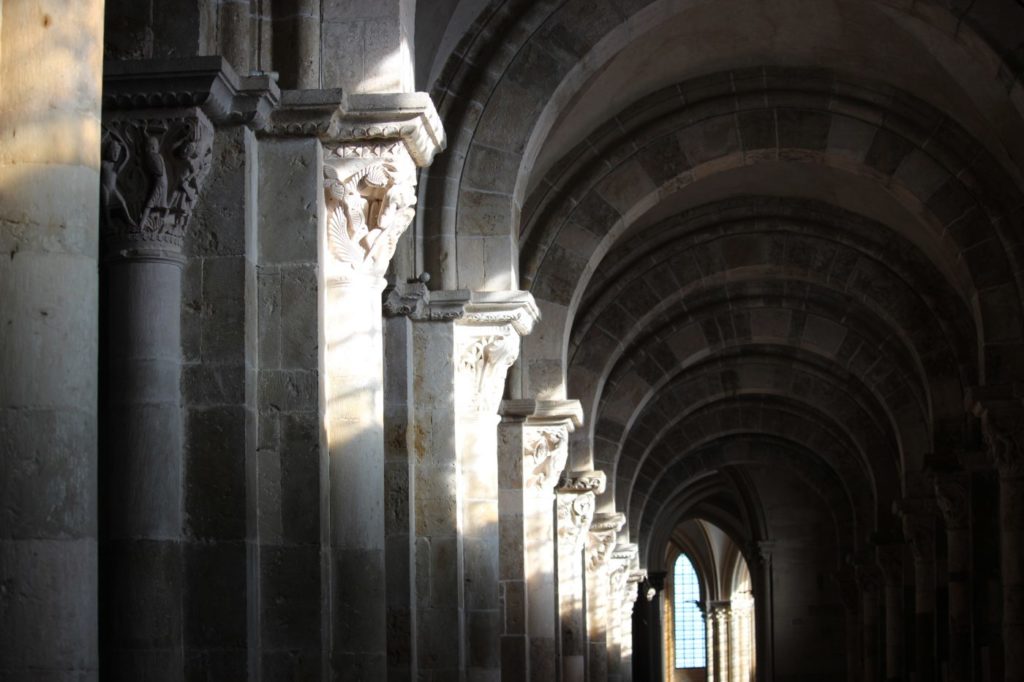
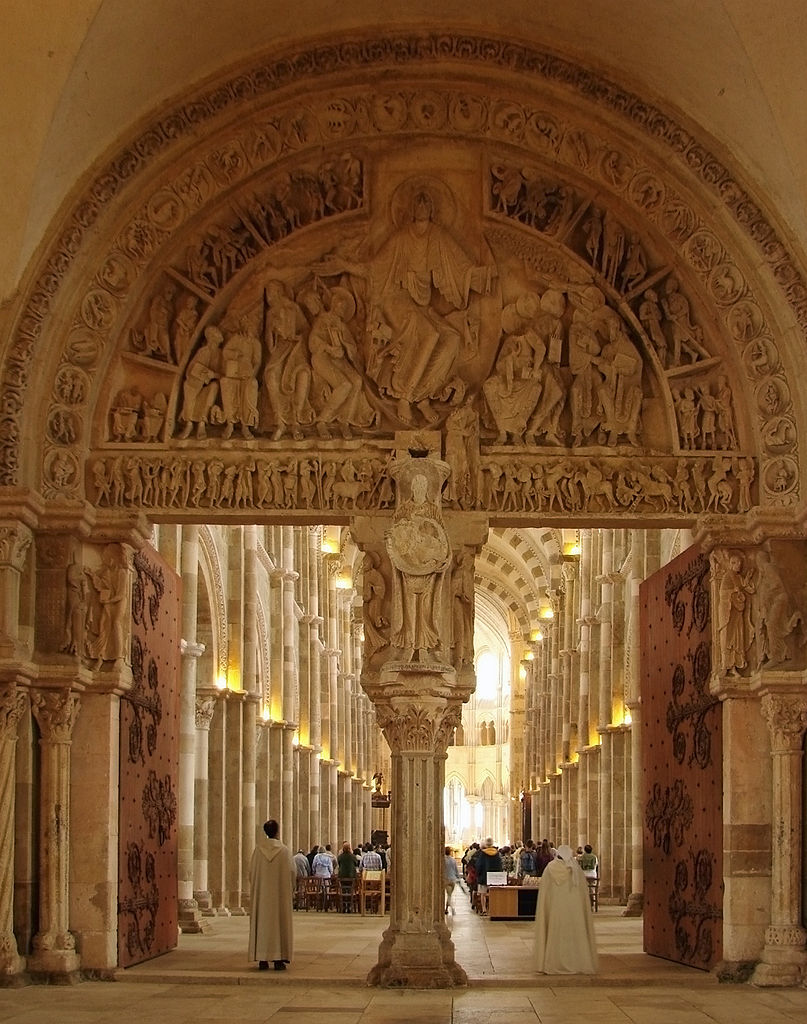
The Basilica of St. Mary Magdalene in Vézelay is one of the great abbeys of Europe. You walk into a huge entrance chamber, built to accommodate the pilgrims flooding into the village. Then go through the typanum into an extraordinary space where the light filters through onto the warm stone-flagged floors and lights up the intricate sculptures around the columns of the nave. At midsummer the light floods through the window onto nine spots in the nave that converge onto the altar.
Two different routes start from Vézelay
There are two different routes from Vézelay to the village of Gargilesse-Dompierre where they join up.
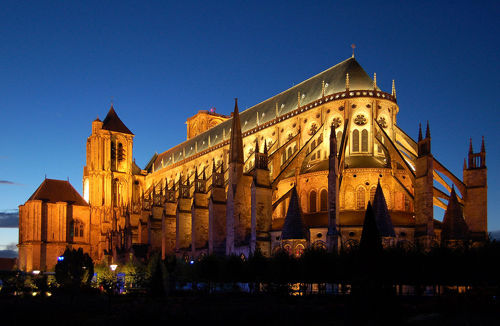
The northern route goes through Bourges, a city well worth a stopover for its magnificent gothic cathedral and old quarter full of medieval buildings.
The southern routes takes in Nevers, focus for the religious as the cathedral contains the shrine of Saint Bernadette Soubirous (of Lourdes).
Into the Limousin and the Dordogne

From Gargilesse-Dompierre the route continues across the foothills of the Limousin to Limoges, famous for its production of fine china produced, much of which is on display in the Fine Arts Museum. The next big city, Périgueux, is the capital of the Dordogne department.
Into the eastern part of Les Landes
The route winds through the wine area of Bordeaux and on to the huge pine forest of Les Landes.
Pilgrims made the hazardous crossing over the Adour river at Saint-Sever, noted for its abbey, old houses and ramparts and views over the river. The trail joins two other Camino de Santiago routes (from Tours and Le Puy-en-Velay) near Ostabat.
The official route follows the old historic Way. Today’s GR 654, the Sentier de Saint-Jacques – Voie de Vézelay, goes a slightly different route, avoiding busy main roads. The GR 654 is for long-distance walkers and is a much longer route.
It’s 900 km/560 miles from Vézelay to St Jean Pied-de-Port.
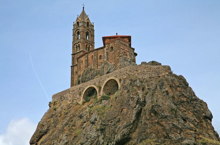
The Way of Le Puy

The Way of Le Puy (Via Podensis) is the most popular and the best organized of the modern pilgrim walking routes. It starts in Le Puy-en-Velay in the Auvergne, one of the undiscovered gems of this volcanic region.
From Le Puy, you walk over plains and through forests, past tiny chapels with their surprising black madonnas and villages where nothing much seems to happen. Then it’s a wonderful countryside hike over a high plateau to Saugues and its English Tower.
Into the Lozère

Move into the Lozère region, and the architecture changes as red tiled rooves give way to black slate. The Aubrac hillsides are bleak uplands where the views stretch for miles and the villages sit squat in the windswept landscape.
The Lot Valley

The route continues onto the Lot Valley, a gentler place where you reach Espalion with its remarkable views. On to charming Entraygues perched beside the river with an ancient château overlooking the Truyère river.
Don’t miss the perfect medieval village of Conques. It has a beautiful, vast Abbey, a treasure, old cobbled streets, and a monk who gives an extraordinary organ recital each evening.
From here you climb up the hillside from Figeac to Limogne-en-Quercy then through flat woodland trails through the Les Causses Park and past dolmens and ancient stone structures.

The route from Cahors to Moissac takes you along river valleys then over the Garonne into the department of Le Gers. Then it’s Armagnac brandy country.
The countryside changes as the route makes its way into the Basque country and the foothills of the Pyrenees at Ostabat and St-Jean–Pied-de-Port.
The route has been extended and you can start in Geneva. It’s 740 km (460 miles) from Le Puy-en-Velay to St-Jean.
The Way of Arles
The Way of Arles (Via Tolosana) runs along much of GR 653 from the south of France and Italy.
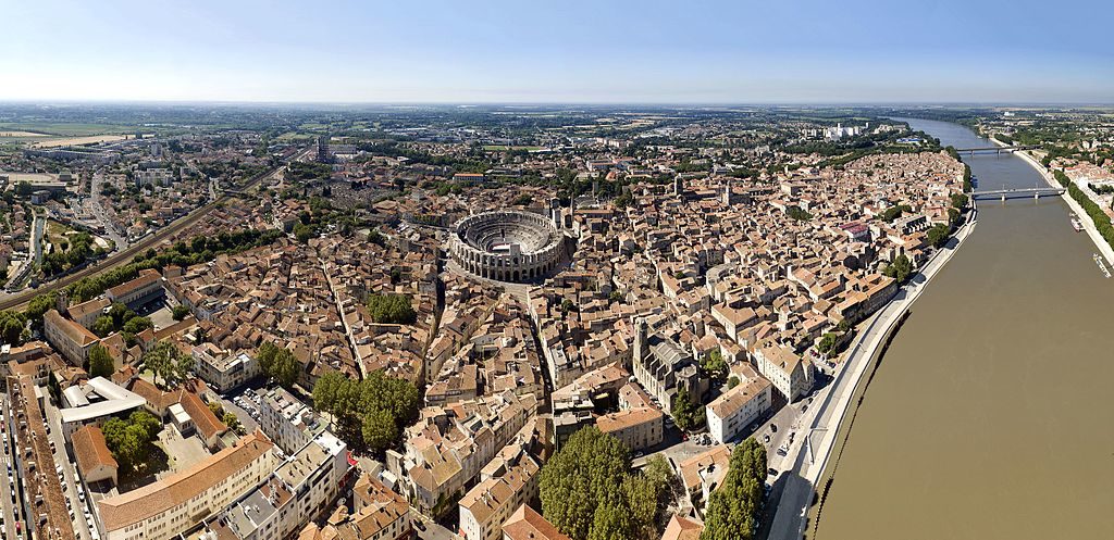
The route starts in the old Mediterranean Roman city of Arles. The route continues to skirt the Mediterranean, going via the great city of Montpellier. It then makes its way north-west out of the main tourist areas. It goes up over the famous Pont du Diable to the medieval village of St-Guilhem-le-Désert with its Benedictine 9th-century Abbey.
The Hérault gives you panoramic views from its plateaus. They you pass the stalactite wonders of the Grotte de Clamouse and the St-Michel-de-Gramont monastery before reaching Lodève.
Into deep countryside
From here the route starts climbing up to the Haut-Languedoc massif and the Regional Natural Park with its forests and paths which make some of the route difficult to navigate.
Castres is an attractive town with the colourful houses of the tanners’ quarters reflected in the river. You’re in Toulouse-Lautrec country here, though you miss Albi with its museum devoted to the diminutive painter.
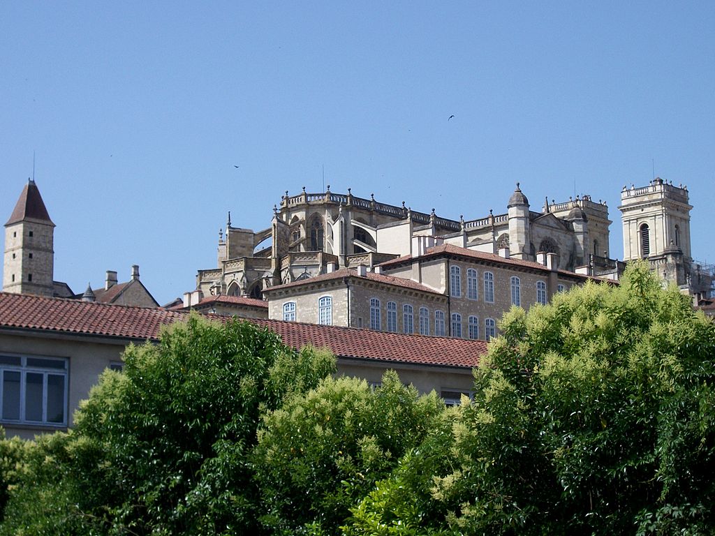
Next you’re in the Gers region, the heart of Gascony. Turning south, you get to the Canal du Midi which takes you into the important city of Toulouse. For pilgrims, it’s the Basilique Saint-Sernin, begun in 1080 to cope with the pilgrims, that is the high point here.
West from Toulouse
Now the route goes directly west through plains and forests onto Auch, its dramatic cathedral towering over the town. From there it’s south to Pau, that most English of French towns (think croquet and cricket), and down to Oloron-Sainte-Marie. From here it’s a short distance to St. Jean-Pied-de-Port just near St Jean.
The route is 800 km (497 miles) long.

Tips on the pilgrim walking routes in France
- To start planning, get the special map on a scale of 1:100000. France, sentiers de grande randonnée is published by the Institut Géographique National (IGN).
- The Fédération Francaise de la Randonnée Pédestre (FFRP) is the organization behind the long distance footpaths – les sentiers de grande randonnée (GR) which exist all over the country. Unfortunately the site is in French only.
- Try GR website for English more general information.
- Most of the GR trails run through villages where you can find hotels, bed and breakfasts (chambers d’hote), gîtes d’étape which are small hostels and campsites.
- Check out the budget hotel chains in France for cheap accommodation on your walk.
More on the Geography of France
Regions of France
Departments of France
Main Rivers of France
The 7 Main Mountain Ranges of France